
Conserving Afghanistan's Endangered Wildlife
By Khalid Rahimi / Oct 12
What if the very land you walk on could tell you stories of survival and adaptation? Afghanistan’s diverse climate, shaped by its rugged terrain, profoundly impacts its people and their agricultural practices. Understanding these connections is vital for appreciating the rich cultural tapestry of this nation.
Delve into the contrasting climate patterns across Afghanistan's diverse provinces, highlighting temperature extremes, precipitation differences, and their profound impact on agriculture and local livelihoods. The visual below compares seasonal variations and regional rainfall distribution.
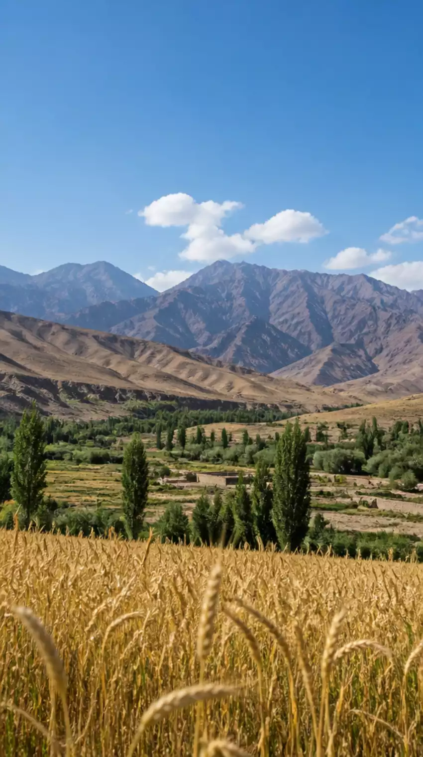
Afghanistan's climate is as diverse as its landscapes, shaped significantly by its rugged topography and geographical location. Understanding the weather patterns is essential for appreciating the rich cultural tapestry of the nation. From the arid desert regions to the mountainous north, the climate influences daily life, agriculture, and even the migration patterns of its people. For more detailed insights into Afghanistan's geography and climate, you can refer to resources like The World Factbook.
With my years of exploration across Afghanistan, I've witnessed firsthand how the climate impacts not only the environment but also the traditions and lifestyles of its inhabitants. Let's delve deeper into the arid and semi-arid landscape that defines much of Afghanistan.
Afghanistan's predominant climate is categorized as continental, which encompasses both arid and semi-arid regions. This classification signifies vast temperature differences between seasons, with summers often blazing hot and winters chillingly cold. Within this context, it's fascinating to see how geography intertwines with climate, affecting everything from agriculture to habitation.
These characteristics of the continental climate not only create distinct seasonal variations but also mold the cultural practices of communities living within these climates. Hot summers can lead to intense agricultural challenges, while cold winters necessitate adaptations in housing and lifestyle.
The continental climate of Afghanistan has profound implications for its inhabitants. The temperature can reach highs of over 40°C (104°F) in the summer, while winters can drop to below -20°C (-4°F) in mountainous regions. This dramatic variability shapes various aspects of life, from clothing to food storage. For instance, during winter, many families rely on preserved foods and warm clothing to brace against the cold.
During the summer months, the stark heat influences agricultural practices significantly. Farmers must time their planting carefully to avoid extreme temperatures that could damage crops. In contrast, the biting cold of winter brings challenges such as snow-covered roads, impacting trade and travel. Seasonal festivals often reflect these climatic nuances, celebrating the harvest in fall or the arrival of spring. The World Bank Climate Change Knowledge Portal provides additional data on seasonal variations.
The temperature varies dramatically across Afghanistan's regions, which can be attributed to its diverse geography. For example, the lowlands of the southern provinces like Kandahar experience more extreme heat compared to the cooler highlands of Bamiyan. This regional variability is crucial for understanding how different communities adapt their lifestyles and agricultural practices.
As we explore further, it becomes evident that the interplay of climate across different provinces not only affects the environment but also the very fabric of Afghan society.
Now that we have a solid grasp of Afghanistan's general climate, let’s examine how these patterns shift from province to province. Each area holds its unique climate characteristics, shaped by geographical features and elevation, which directly influence local agriculture and water availability. Understanding these differences is essential for those keen on exploring the land or conducting research.
Afghanistan’s northern regions typically experience harsher winters with significant snowfall, while the southern provinces have a more moderate climate. This north-south gradient creates diverse agricultural opportunities and challenges. In the north, farmers often rely on snowmelt for their crops, while in the south, irrigation from rivers is crucial.
This comparative analysis highlights the necessity for tailored agricultural practices that meet the specific needs of each region’s climate. By adapting to these local conditions, farmers can optimize their crop yields and contribute to food security.
Rainfall patterns in Afghanistan are equally significant in understanding climate impacts. The distribution of rain varies greatly; northern regions receive more precipitation, whereas southern provinces often grapple with drought. This rainfall variability directly affects water resources and agricultural productivity.
The impact of rainfall distribution extends beyond agriculture, influencing local economies and community livelihoods. For instance, areas relying heavily on irrigation face significant challenges during dry spells or changes in rainfall patterns.
In provinces such as Nangarhar and Kabul, the effects of the monsoon season can be pronounced. During this time, increased rainfall can lead to both opportunities and challenges for local farmers. The additional moisture can benefit crops, but it can also result in flash floods if not managed properly.
As we continue our exploration of Afghanistan’s climate, it's evident that each province presents unique challenges and advantages shaped by its geographical and climatic conditions. By understanding these factors, travelers and researchers alike can gain deeper insights into the heart of Afghanistan.
To maximize agricultural productivity in Afghanistan's diverse climate, consider utilizing crop rotation and selecting drought-resistant varieties. Understanding the unique climate characteristics of each province can significantly enhance crop yields and ensure food security.
As we delve into the landscape of Afghanistan, it's essential to recognize the interconnectedness of climate, terrain, and agriculture. Understanding how these elements interact not only enriches our view of this beautiful country but also guides us in effective agricultural planning. As a passionate geographer, I often emphasize how regional variations significantly influence farming practices and crop yields across Afghanistan. Information regarding climate adaptation strategies can be found on the UNDP Adaptation Portal.
Here are a few key takeaways to consider:
Being mindful of these factors, farmers can optimize their strategies to overcome regional challenges, ultimately enhancing food security and sustainability.
The relationship between climate, terrain, and agriculture is particularly evident when we explore Afghanistan's varied landscapes. Each region presents unique characteristics that influence farming methods and outcomes. For instance, in the mountainous areas, where temperatures can be cooler, farmers might focus on hardier crops, while the plains may favor more temperature-sensitive varieties.
By leveraging this understanding, we can support local farmers in adopting better practices and technologies that respect the natural environment and foster growth.
Recognizing the specific agricultural needs of each province helps in devising tailored strategies. Regional variations can dictate everything from what crops to plant to how best to allocate irrigation resources. For example, farmers in Nangarhar benefit from more rainfall, allowing them to grow a wider variety of crops as compared to those in the drier provinces.
The following aspects are vital for effective agricultural planning:
By embracing these strategies, we can work towards ensuring food security and sustainability in Afghanistan's agricultural landscape.
Each province in Afghanistan boasts its own set of opportunities and challenges in agriculture. For example, while provinces like Herat and Kandahar are known for their rich soil and favorable climates, they also face risks from drought and resource scarcity. Understanding these dynamics is essential for farmers and policymakers alike.
Key factors to explore include:
By examining these agricultural zones, we can cultivate a more holistic approach to farming that embraces the unique characteristics of each region.
Visual tools, such as maps and charts, offer powerful insights into Afghanistan’s climate and agricultural landscape. They allow us to grasp the complexities of weather patterns and their implications for farming. As someone who enjoys merging geography with storytelling, I believe that visual data can make these intricate connections more accessible and engaging.
To truly appreciate the climate and geography of Afghanistan, utilizing maps and charts can be incredibly insightful. These tools provide a visual representation of rainfall distribution, temperature variations, and agricultural potential across provinces.
By engaging with these visual resources, we can foster a deeper understanding of how climate influences agriculture in Afghanistan.
Rainfall and crop suitability maps are essential for assessing the potential for agricultural productivity. By visualizing this data, farmers can make informed decisions about what crops to plant and when. For instance, regions that receive higher rainfall can support a wider variety of crops, while drier areas may require more resilient plant varieties.
Key benefits of utilizing visual data include:
These tools not only aid in immediate planning but also contribute to long-term agricultural strategies that consider climate variability.
Visualizing temperature and precipitation levels allows us to understand better the climatic trends affecting agriculture. By tracking these patterns over time, we can identify potential challenges and opportunities for farmers in Afghanistan.
Utilizing climate data visualization can provide insights such as:
With this knowledge in hand, farmers can adapt their practices to align more closely with the evolving climate landscape.
As we reflect on the influence of climate on agriculture, it’s clear that ongoing research and adaptation are critical. Addressing climate challenges isn't just about understanding the current landscape; it's about preparing for what lies ahead. As an advocate for sustainable practices, I urge the community to consider these aspects seriously.
Promoting sustainable agricultural practices is vital for enhancing resilience against climate variability. Farmers can adopt methods that respect the land while optimizing productivity.
Some strategies include:
By encouraging sustainable practices, we can pave the way for a more resilient agricultural sector in Afghanistan.
Drought conditions pose significant risks to agriculture, particularly in regions prone to water scarcity. Therefore, effective water resource management is essential for maintaining agricultural productivity.
Potential strategies to address these challenges include:
By focusing on these proactive measures, we can help farmers navigate the challenges posed by drought and secure their livelihoods for the future.
Here is a quick recap of the important points discussed in the article:
By Khalid Rahimi / Oct 12
By Khalid Rahimi / Oct 03
By Khalid Rahimi / Sep 26